Easy access
Morning
Afternoon

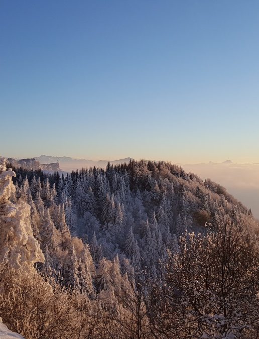
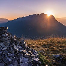
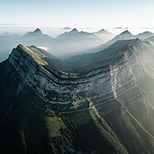
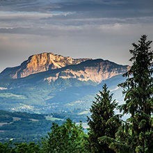
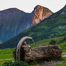
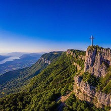
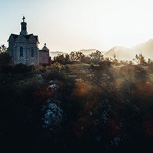
A great classic snowshoeing trail that takes you to the lookout at the wayside cross overlooking the valley.
Departure from Plateau Sud at La Féclaz
From the Plateau Sud car park, follow the snowshoe signs for Le Nivolet along the groomed track to the right of the cross-country ski runs. Leave the cross-country track on your left and head towards the Chalets de Glaise. Be careful when crossing the road. You will soon be on the wide expanses of the Glaise pastures. Stay on the edge of the forest until you reach the next signpost.
At the Glaise signpost, continue left into the forest. A wide forest track will guide you to the summit. It's a fairly long climb, so be patient!
At the summit, a small clearing invites you to take a breather before heading left towards the Croix du Nivolet. You'll find a shelter before the viewpoint. On the way back, retrace your steps to the small clearing.
Leave the route you took on the way up and turn slightly left onto a hilly, wooded path. As you leave the forest, fork right before the chalet and descend the fairly steep path to the level.
Then continue straight ahead on the groomed and waymarked Plateau de Glaise trail to reach the resort. Alternative route: From the Sire car park, set off for a 6km hike, about 2h30 each way. Go up to the right of the pistes, behind the restaurant, to the ridge. At the chalets, follow the "Croix du Nivolet" signs. Return the same way.
0/ Departure from Plateau Sud at La Féclaz
1/ From the Plateau Sud car park, follow the snowshoe signs for Le Nivolet along the groomed track to the right of the cross-country ski runs. Leave the cross-country track on your left and head towards the Chalets de Glaise. Be careful when crossing the road. You will soon be on the wide expanses of the Glaise pastures. Stay on the edge of the forest until you reach the next signpost.
2/ At the Glaise signpost, continue left into the forest. A wide forest track will guide you to the summit. It's a fairly long climb, so be patient! At the summit, a small clearing invites you to take a breather before heading left towards the Croix du Nivolet. You'll find a shelter before the viewpoint.
3/ On the way back, retrace your steps to the small clearing. Leave the route you took on the way up and turn slightly left onto a hilly, wooded path. As you leave the forest, fork right before the chalet and descend the fairly steep path to the level. Then continue straight ahead on the groomed and waymarked Plateau de Glaise trail to reach the resort.
4/ Alternative route:
From the Sire car park, set off for a 6km hike, about 2h30 each way. Go up to the right of the pistes, behind the restaurant, to the ridge. At the chalets, follow the "Croix du Nivolet" signs. Return the same way.
From 01/12 to 31/03.
Subject to snow conditions.
| Elevation gain | 355 m |
| Nature of the ground | Non-groomed itinerary |
| Way marking | Jalons métalliques avec marqueur jaune |
| Cartographic references | Map TOP 25 IGN 3332 OT, Chambéry-Aix-Les-Bains |
| Animaux |
Pets allowed
Hosting conditions: Les animaux doivent être tenus en laisse à tout moment. |
Parking nearby
Pets welcome
Additional information on pricing:
Plan raquettes en vente à l'office de tourisme au prix de 1.50€